Offline GPS Tracker
Most GPS trackers stop working the moment you leave cell coverage. Loko doesn't. 20 km LoRa range — no SIM card, no subscription, no internet required. Track pets, drones, and farm equipment anywhere on Earth.


Loko GPS Tracker Features
Advanced LoRa P2P technology for reliable offline GPS tracking in the most challenging environments. No internet or cellular network required. Compare our offline GPS tracker with traditional cellular solutions!
+20km LoRa Range
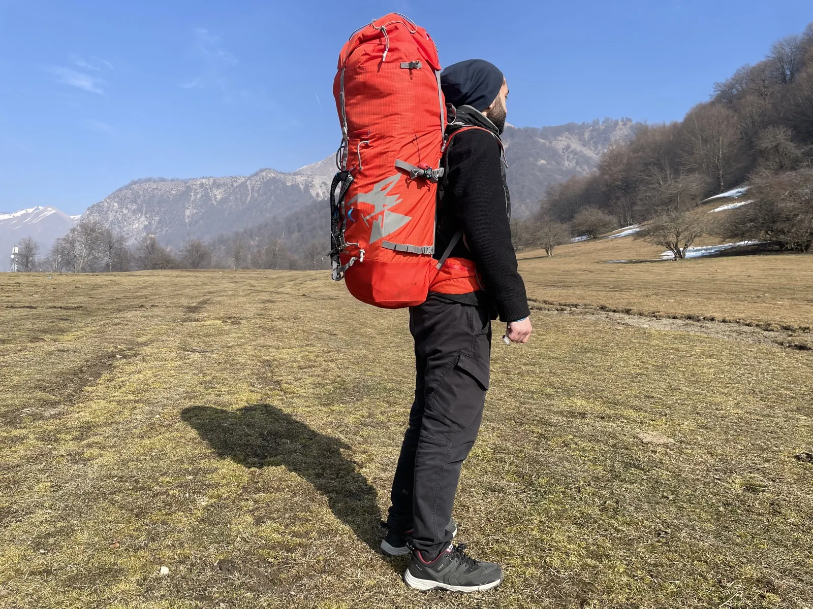
Maintains reliable tracking up to 20km away using LoRa P2P technology—that's 10x the range of Bluetooth trackers. Whether you're monitoring livestock across expansive farmland or hiking through vast wilderness, our offline GPS tracker keeps you connected.

True Offline GPS
The Loko App allows users to download geographic regions for offline use, enabling uninterrupted GPS tracking and navigation with zero network dependency. Perfect for remote areas without cellular coverage. Unlike other GPS trackers that fail without internet, our offline GPS tracker works anywhere.
30-Day Battery Life
Loko uses a low-power LoRa architecture and lithium battery to deliver up to 1 year of GPS tracking on a single charge — depending on transmit interval. Fully recharges via USB in ~60 minutes. Extended with solar charging option.
Ultra-Compact
Weighing just 14 grams and smaller than a matchbox, Loko is the world's smallest offline GPS tracker. Easy to attach to any item—pets, equipment, vehicles, or drones. Unobtrusive design doesn't compromise on power or range.

Data Logger Mode
Set Loko as a standalone data logger to record GPS coordinates autonomously. Stores up to 6,500 location points in onboard memory—ideal for tracking routes, mapping terrain, or monitoring movement patterns over extended periods without needing a live connection to your phone.
Offline Map Download
Download any region's map directly in the Loko app before you head out—then use full GPS tracking and navigation with zero cell service. Whether you're deep in the mountains, dense forest, or any remote area, the Loko app works completely offline. No Wi-Fi, no mobile data, no signal needed.
Encrypted Data Transmission
Every GPS position sent from the Loko Air transmitter to the Ground receiver is protected with AES-128 encryption. Your location data stays completely private—no third-party servers, no cloud exposure, no interception. End-to-end security over the direct LoRa radio link.
Real-World Applications
From pets to precision agriculture, discover how Loko transforms tracking across industries with reliable, offline GPS technology that works anywhere—no subscriptions, no limits.
GPS Pet Tracker
Never lose sight of your adventurous companions. Loko attaches to any collar and delivers real-time location updates even where cell service fails—perfect for dogs, cats, and outdoor pets. Zero monthly fees, unlimited peace of mind.
High-Altitude Balloon Tracking
Built for the extremes. Track atmospheric research balloons with continuous position data at altitudes and temperatures where conventional trackers fail. Lightweight, reliable, and proven in stratospheric conditions.
Drone Recovery System
Your drone's last line of defense. At just 14 grams, Loko provides independent backup tracking when primary systems fail. Transmits last-known position up to 20km away—ideal for FPV racing, commercial ops, and remote flights. Never lose a drone again.
Farm Equipment Tracking
Protect your investment across every acre. Monitor tractors, harvesters, and equipment in real-time—no cellular network required. Track up to 30 assets from one station, get theft alerts, and enjoy 12-month battery life. Built for the rugged demands of modern agriculture.

Military GPS Tracker
Secure positioning for mission-critical operations. AES-128 encrypted communications, zero infrastructure dependence, and rugged mil-spec construction. Designed for tactical environments where reliability and security are non-negotiable.
Backcountry Safety Tracker
Your lifeline in the wilderness. Track your position and share it with loved ones even in areas with zero cell coverage. Features SOS emergency beacon for search and rescue, multi-day battery life, and weatherproof construction for any adventure.
How Loko Works
Loko offers two powerful communication modes to track your assets anywhere, anytime.
Peer-to-Peer (P2P) Mode
Direct LoRa communication between your Loko tracker and smartphone—no internet, no subscription, no monthly fees. Perfect for outdoor adventures and remote locations.

Tracker communicates with Receiver via LoRa P2P (up to 20km), then Receiver connects to your phone via Bluetooth
LoRaWAN Network Mode
Connect to public or private LoRaWAN networks for extended range and global tracking. Access your tracker's location from anywhere in the world via the cloud.

Loko Air sends data to LoRaWAN gateway, gateway forwards to cloud server, your phone accesses data from cloud
GPS Tracking Guides by Use Case
Compare offline GPS tracking options for rural, remote, and no-cell-service environments.
Loko GPS Tracker App
Download the Loko mobile app for iOS, Android, or LineageOS and monitor your GPS tracker from anywhere. Real-time location updates, offline maps, geofencing alerts, and detailed tracking history—all in one intuitive interface. Works completely offline for GPS tracking without internet.


Real-Time Tracking
Get live GPS location updates every few seconds with precision positioning across multiple GNSS systems.
Offline Maps
Access offline maps downloaded on your device—perfect for remote areas without internet connectivity.
Geofencing Alerts
Set custom zones and receive instant notifications when your tracker enters or exits defined boundaries.
Detailed History
Review complete tracking history with timestamps, routes, and detailed analytics of movement patterns.
Private & Secure
End-to-end encrypted communication with no server data storage—your privacy is fully protected.
Loko GPS Tracker Technical Specifications
Detailed hardware and software specifications for the world's smallest offline GPS tracker using LoRa P2P technology.
GPS Tracker Comparison
How Loko compares to other tracking technologies and competitors.
By Technology
| Technology | Monthly Cost | Range | Infrastructure |
|---|---|---|---|
| Loko (LoRa P2P) | $0 | 20km | Own Base Station |
| LoRaWAN Guide | ~$1-5 | 20km+ | Gateways |
| Cellular | $5-50+ | Network Dependent | Cell Towers |
| Satellite | $20-100+ | Planet-wide | Satellites |
vs Competitors
| Feature | Loko | Tile | AirTag |
|---|---|---|---|
| Range | 20km | 30-120m | 30-120m |
| Subscription | None | None | None |
| Battery | 1 year | ~1 year | |
| Offline | Yes | No | Limited |
| Price | $59 | $25-50 | $29 |
Loko's long range, offline capability, and zero subscription fees make it ideal for remote and agricultural use.
Customer Success Stories
Real-world examples of how customers across the globe use Loko GPS Tracker for their tracking needs.
"Saved Our Prize Bull" - Australian Rancher
"We attached a Loko tracker to our prize breeding bull before turning him out with the herd. When he wandered off during a storm, we located him within 2 hours using the offline GPS tracking. Without cellular coverage in our remote area, a cellular tracker wouldn't have worked. Saved $15,000 investment!" - Sarah M., Queensland, Australia
"Perfect for Drone Racing" - Estonian Pilot
"As a professional drone racing pilot, I need to recover my expensive racing drones when crashes happen. Loko's 14g tracker adds minimal weight while providing reliable backup tracking. Last month it helped me recover a $3000 drone from dense forest where GPS failed." - Marko R., Tallinn, Estonia
"Best Pet Tracker for Rural Areas" - Japanese Farmer
"My hunting dog loves to chase game deep into the mountains where no cellular service exists. Other pet trackers failed, but Loko works perfectly with its offline capability. Peace of mind knowing I can always find my loyal companion." - Hiroshi T., Hokkaido, Japan
Choose Your Plan
Select the perfect tracking solution for your needs. All plans include LoRa P2P technology and no subscription fees.
Loko Bundle
One-time purchase
Loko Air
One-time purchase
Loko GPS Tracker: Frequently Asked Questions
Everything you need to know about the Loko GPS Tracker. Can't find an answer? Contact our support team.
Loko is the world's smallest, lightweight, open-source GPS tracker designed for real-time location monitoring. It uses LoRa P2P radio communication (no SIM card required) and is ideal for tracking drones, pets, equipment, or belongings in areas without cellular coverage. Its ultra-low power consumption allows up to 1 year of battery life on a single charge, depending on transmit interval.
Loko GPS Tracker operates with two units: Air Unit (transmitter) attaches to your device and sends GPS data via LoRa P2P radio. Ground Unit (receiver) receives data from the Air Unit and transmits it to a smartphone app via Bluetooth. The app displays locations on a 2D map. No internet or cellular network required for GPS tracking.
Loko GPS Tracker is crash-resistant, water-resistant, and dustproof. Note that Loko is not waterproof. it is not recommended to put under water. Designed for outdoor GPS tracking in tough conditions.
Up to 30 Loko Air GPS tracker units can pair with a single Ground Unit, each assigned a unique ID. Perfect for tracking multiple assets simultaneously.
Loko GPS Tracker can integrate with existing LoRaWAN® gateways for IoT applications. It also features direct LoRa P2P communication for offline GPS tracking without infrastructure dependence.
Loko GPS Tracker is sold through SeeedStudio, with worldwide shipping handled by SeeedStudio. Order the world's smallest GPS tracker today with LoRa P2P technology.
No! Unlike competitors, Loko GPS Tracker operates without subscription fees. Our offline GPS tracking technology uses LoRa P2P communication with no ongoing costs.
The Air Unit (GPS tracker transmitter), Ground Unit (receiver), antenna, solar panel, and mounting accessories. Complete offline GPS tracking system with LoRa P2P technology.
Yes! iOS and Android apps available for GPS tracking. Download the Loko app for complete offline GPS tracking functionality with no internet required.
Absolutely. Loko GPS Tracker schematics, firmware, and software are open-source and available on GitHub. The world's smallest open-source GPS tracker with LoRa P2P technology.
The correct name is Loko GPS Tracker. It's often misspelled as "Loco GPS tracker" or "Loco tracker" — if you searched for a Loco GPS tracker with LoRa P2P and no SIM card, Loko is the product you're looking for.
Loko GPS Tracker can integrate with TTN for extended network coverage using existing LoRaWAN infrastructure. This enables GPS tracking in areas with LoRaWAN gateways while maintaining P2P capability.